


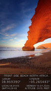
GPS Camera with latitude and longitude

คำอธิบายของGPS Camera with latitude and longitude
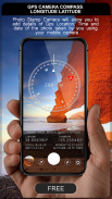
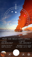
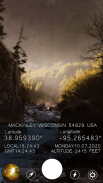
GPS Camera can help you to add the address, location coordinates direction, altitude, current date & time & note in the picture.There is a coordinate converter to switch between any of the common coordinate systems including Lat/Long, UTM, and MGRS so it can work with any physical map.
You can also set the camera function , such as flash on / off, night, zoom, the resolution of the camera ...
After you finish your shot, you can save it or share it with your friends directly in the action press the icon. You can also view photos you took using his picture browser.
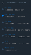
* Coordinate types:
- Dec Degs (DD.dddddd˚)
- Dec Degs Micro (DD.dddddd "N, S, E, W")
- Dec Mins (DDMM.mmmm)
- Deg Min Secs (DD°MM'SS.sss")
- Dec Mins Secs (DDMMSS.sss")
- UTM (Universal Transverse Mercator)
- MGRS (Military Grid Reference System)
กล้อง GPS สามารถช่วยให้คุณเพิ่มที่อยู่ทิศทางพิกัดตำแหน่งระดับความสูงวันที่ & เวลาปัจจุบัน & หมายเหตุในรูปภาพมีตัวแปลงพิกัดเพื่อสลับระหว่างระบบพิกัดทั่วไปเช่น Lat / Long, UTM และ MGRS ดังนั้น มันสามารถทำงานกับแผนที่ทางกายภาพใด ๆ
นอกจากนี้คุณยังสามารถตั้งค่าฟังก์ชั่นกล้องเช่นแฟลชเปิด / ปิด, กลางคืน, ซูม, ความละเอียดของกล้อง ...
หลังจากที่คุณถ่ายเสร็จคุณสามารถบันทึกหรือแชร์กับเพื่อนของคุณโดยตรงในการดำเนินการกดไอคอน คุณสามารถดูรูปภาพที่คุณถ่ายโดยใช้เบราว์เซอร์รูปภาพของเขา
* ประเภทพิกัด:
- Dec Degs (DD.dddddd˚)
- Dec Degs Micro (DD.dddddd "N, S, E, W")
- ธ.ค. นาที (DDMM.mmmm)
- Deg Min Secs (DD ° MM'SS.sss ")
- Dec Mins Secs (DDMMSS.sss ")
- UTM (Universal Transverse Mercator)
- MGRS (ระบบอ้างอิงตารางทหาร)


